Cambridge VermontHIKING TRAILS & PLACES TO HIKE
Listed below are the best hiking trails and places to hike near Cambridge, Vermont.
1. Spruce Peak and Sterling Pond Loop
SCENIC FALL FOLIAGE HIKE
Spruce Peak and Sterling Pond Loop is a 3.38-mile trail with 1,204 feet of elevation gain near Cambridge, Vermont. This moderately difficult trail offers prime views of fall foliage, making it an absolute must-visit during September or early October. The loop provides a beautifully scenic experience that showcases New England's autumn colors at their finest.
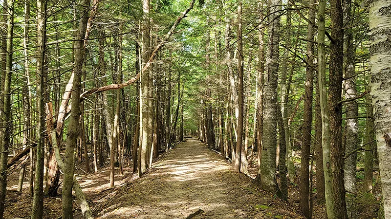
2. Sterling Pond Trail
ACCESSIBLE MOUNTAIN POND TREK
Sterling Pond Trail is a 2.28-mile path with 876 feet of elevation gain located across from a parking area on Route 108. The trail is accessible during warmer months but requires a longer approach in winter when Route 108 closes to vehicles. Hikers are rewarded with a beautiful mountain pond at the end of this moderately challenging trek.
3. Mt. Mansfield via the Long Trail
VERMONT'S HIGHEST PEAK
Mt. Mansfield via the Long Trail offers a 5.27-mile journey with 2,743 feet of elevation gain to Vermont's highest summit. This challenging trail represents the most popular eastern approach to the mountain, part of Vermont's iconic Long Trail system. The path provides spectacular views and a true Vermont mountain experience for experienced hikers.
4. Lamoille Valley Rail Trail
SCENIC RAIL-TO-TRAIL PATHWAY
The Lamoille Valley Rail Trail passes through Cambridge as part of a longer rail-trail conversion project in Vermont. This relatively flat, accessible trail follows the former railroad corridor, making it ideal for hikers of all ability levels. The trail showcases beautiful Vermont landscapes with forests, fields, and river views along its route.
5. Peter A. Krusch Nature Preserve
PEACEFUL WOODLANDS RETREAT
The Peter A. Krusch Nature Preserve in Cambridge offers well-marked trails through serene woods and open meadows. This accessible preserve provides visitors with a chance to connect with Vermont's natural environment on gentle pathways. The preserve's diverse habitats support local wildlife and plant communities, creating an enriching outdoor experience.
6. Cross Vermont Trail
MULTI-USE RECREATION PATH
The Cross Vermont Trail segment near Cambridge forms part of a longer trail network spanning the width of Vermont. This multi-use pathway welcomes hikers of various skill levels with its generally moderate terrain. The trail passes through quintessential Vermont landscapes, connecting natural areas and communities along its route.
7. Lincoln Gap via Long Trail
CHALLENGING MOUNTAIN PASSAGE
Lincoln Gap via Long Trail is a 3.2-mile one-way hike in Green Mountain National Forest near Cambridge. This challenging trail section features significant elevation changes and rugged terrain suitable for experienced hikers. The path rewards adventurers with stunning views of Vermont's Green Mountains and a true wilderness experience.
8. Deer Leap Mountain Trail
SPECTACULAR VISTA HIKE
Deer Leap Mountain Trail offers spectacular panoramic views from its summit overlooks not far from Cambridge. This moderate trail challenges hikers with some rocky sections but remains accessible to most reasonably fit visitors. The trail's primary reward comes at the top, where hikers can enjoy sweeping vistas of the surrounding Vermont countryside.
9. Thundering Brook Trail
CASCADING WATERFALL PATH
Thundering Brook Trail features lovely waterfalls along a relatively accessible path in the Killington area. This family-friendly trail offers a shorter hiking option with a big scenic payoff at the cascades. The trail includes boardwalks over wetland sections, making it navigable for most ability levels while showcasing Vermont's flowing water features.
10. Weathersfield Trail on Mt. Ascutney
MONADNOCK WATERFALL JOURNEY
The Weathersfield Trail runs 2.9 miles along the south face of Mt. Ascutney, a geological monadnock standing apart from surrounding hills. This challenging trail passes the impressive Cascade Falls, the largest waterfall on the mountain. Hikers can connect with other summit trails via a ridgeline path that follows the mountaintop and crosses the summit area.