Middlesex VermontHIKING TRAILS & PLACES TO HIKE
Listed below are the best hiking trails and places to hike near Middlesex, Vermont.
1. Mount Hunger and White Rocks Mountain
PANORAMIC SUMMIT VIEWS
Mount Hunger and White Rocks Mountain are connected peaks accessed via the Middlesex Trail, offering hikers a challenging route with rocky terrain and rewarding summit vistas. The trail is considered strenuous, involving steady climbing and some scrambling near the top. From the open summit areas, visitors can enjoy expansive views of the Green Mountains, Lake Champlain, the Adirondacks, and even the White Mountains.
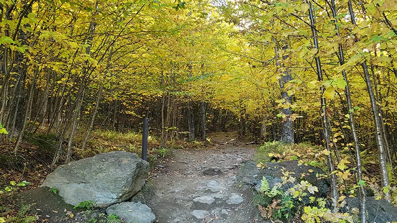
2. Putnam State Forest
WORCESTER RANGE WILDERNESS
Putnam State Forest encompasses much of the higher elevations of the Worcester Range and features multiple hiking trails including those up Mount Hunger and White Rocks Mountain. The terrain is moderate to strenuous, attracting hikers looking for remote woods, wildlife, and northern hardwood forests. The forest also provides opportunities for hunting, fishing, and nature observation in a preserved natural setting.
3. Middlesex Town Forest
WOODED LOCAL TRAILS
Middlesex Town Forest offers a small network of moderate trails, including the scenic Notch Road and Chases Mountain Trail. The Chases Mountain Trail is a 2.2-mile out-and-back route that climbs steadily to the summit, rewarding hikers with two notable vista viewpoints. The forested setting provides a peaceful atmosphere for short to moderate hikes close to town.
4. Middlesex Trails (Class 4 Roads)
HISTORIC RURAL PATHWAYS
Middlesex hosts a network of over 12 miles of Class 4 roads and legal trails, ranging from short .15-mile segments to longer 1.5-mile stretches. The trails traverse quiet woodlands and rural landscapes, providing mostly easy to moderate hiking suitable for all ages, though some unmaintained areas can be muddy or obstructed. Many routes connect, allowing for custom loop hikes and year-round exploration in the rural Vermont countryside.
5. Middlesex Notch Wildlife Management Area
WILDLIFE SPOTTING TRAILS
Middlesex Notch Wildlife Management Area encompasses 630 acres of conserved land open to the public for hiking, wildlife watching, and seasonal recreation. Trails here are generally easy to moderate, winding through diverse habitats including wetlands and forests. This area is ideal for visitors seeking a peaceful hike with opportunities to spot birds and local fauna.
6. Middlesex Wildlife Management Area
SECLUDED NATURAL TRAILS
Middlesex Wildlife Management Area offers 290 acres of public-access land with informal trails that traverse mixed woods and open fields. The trails offer easy to moderate terrain, suitable for hikers, nature enthusiasts, and families. The site provides a tranquil environment for observing wildlife or enjoying a gentle walk away from busier routes.
7. Stowe Pinnacle Trail
ICONIC RIDGE VIEWPOINT
Stowe Pinnacle Trail is a popular moderate to strenuous out-and-back hike in nearby Stowe, leading to an open rocky summit with panoramic vistas of the surrounding valleys and peaks. The trail covers about 3.7 miles round trip and features a series of switchbacks and rocky sections. This destination is beloved for its breathtaking fall foliage and sweeping views of the Green Mountains.
8. Camel's Hump Trail
VERMONT'S ICONIC PEAK
Camel's Hump Trail climbs Vermont's third-highest summit, rewarding hikers with 360-degree views and a unique alpine ecosystem. The main trail is considered strenuous, with rocky climbs and over 2,400 feet of elevation gain across several miles. The mountain is a hallmark of central Vermont hiking and offers unforgettable scenery year-round.
9. Hubbard Park Trails
URBAN FOREST WALKS
Hubbard Park offers over 7 miles of interconnected trails through meadows and forest within the city limits of Montpelier. The trails are easy to moderate, with gentle climbs and several scenic overlooks, including access to the historic stone tower. It's an accessible and family-friendly destination for hiking, picnicking, and wildlife viewing within Vermont's capital.
10. Worcester Range Skyline Trail
RIDGE-LINE ADVENTURE
Worcester Range Skyline Trail connects several major peaks, including Mount Hunger and Mount Worcester, creating a long and challenging traverse for experienced hikers. The terrain is steep and rugged, featuring dramatic ledges, dense forests, and extended ridge walking. This route promises solitude and expansive mountain views across one of Vermont's wildest ridgelines.